Well there is this one site tackamarks.freeservers.com which is no longer online but his pages still can be accessed by using the Internet Archive . But below I’m going to including some of his research about the secret codes in our road signs…
Embedded in our nation’s road sign system is a secret coding designed to target vital sites, facilities, routes and resources for military confiscation during a National Emergency. Though, concealed by the lies of the Department of Transportation for many years, “Free Indeed Research” has tapped deeply into one of the most clever, and deceptive cover-up operations to come down the pike in years! (If you think GPS will be working normally in the scenario described above, think again.)
The United Nations military has plans to become the cop soldiers of the world. Unknown to the general populace, a “Rapid Deployment” force stands ready to enter U.S. borders at the request of the President of the United States during a national emergency. They will perform “peacekeeping” operations such as evacuations, rounding up dissenters, confiscating firearms and incurring facilities and sites for military use. These forces are laced with foreign troops that do not speak English. Therefore, as a tactical advance, all nations have been secretly revamping their roads sign systems to conform to an international standard under the guise of the WTO. It is our belief that these signs and reflective markers “TACMARS” on the backs of many signs are coded to target vital sites, facilities and resources to be confiscated and used by these troops.
More here: http://usahitman.com/secret-military-codes-hidden-road-signs/
And This: Tacmars or Tackamarks - coded signs on roads
Back in the 90's they were putting lots of tacmars on road signs here in Florida, but as word got out and the militia activity increased those tags were removed. I am wondering what people are seeing now.
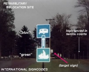
The idea is that when military enters another country they put stickers on the backs of road signs to point the way to a facility. It could be a holding facility, a transportation location to move people, railroad tracks and some are color coded black, red, yellow or blue. They could adjust them obviously as needed. I used the waybackmachine site to look up an older now defunct website dedicated to this issue. Here was a photo at that site:
This helicopter base was discovered behind a V.F.W. in Fife Lake, MI.
The description on the page about this sign group was:
Lots of people say these are date stickers for verifying a sign. This is what the site said about this issue:This facility is a very strategic site. Not only is it marked with these sign codes, but satellite photo markers for GPS (Global Positioning System) have appeared at the entrance drive leading directly to the heliport. Photos/Report at following link.
*NEW INFO*
"Free Indeed Research" has discovered secret, "PROCESSING FACILITIES" where computers will be used to "NUMBER" and sort people.
These sites are right in your own city, town, and village!
Click on link at the bottom of the page.
I have verified with military friends that Tacamars are used.Are they *really* just dating the road signs?
As you view the close-up photo of an M.DOT marker to the right, take an extra hard look and you will see another reason why researchers have labeled this so-called road sign "dating operation" a complete FRAUD! This marker has "NO PUNCHES" on any of the dates!! "Free Indeed Research" has discovered countless, numbers of markers found on Michigan road signs where MDOT employees *forgot* to punch dates out on the sticker! Are these just mistakes? If the goal of this program was to date these signs for warranty and replacement purposes, then how could so many mistakes be made?! Again, the truth reveals that the "real goal" of these markers are NOT for dating purposes, but are military, directional codes, designed to guide troops to targeted sites and facilities for incursion and confiscation!
Read More Here: http://projectavalon.net/forum4/showthread.php?45266-Tacmars-or-Tackamarks-coded-signs-on-roads


They are not secret; it makes sense to communicate where things are located; the COG (continuation of gov.) Program is old. Why would this be secret? It is specified cant for public safety. If they are ever used...then we will see if there are abuses. But an event that changes life as we know it...it may be necessary to cage combatants foreign or ....more likely domestic. It will not be your grandma or cousin who was a wall street protestor. It will be people attacking rich neighborhoods or looters who get caught...gangs...psychogroups...NOT EVERYONE WHO IS VOCAL AGAINST THE GOVERNMENT...some criticism...even highly negative is necessary for growth...this is no conspiracy...all nations must prepare for wholesale rioting. It will come if INEQUALITY is ignored for much longer...it is a matter of time. Many poor hate the greedy rich.
ReplyDeleteThis does not make ANY sense! "They are not secret;" If they are not secret, why are they diguising these markers as "date install tags"? Why are they "highly reflective" to be seen at night. I have seen them looking through rear-view mirrors, when you put on you brake lites--they light up like christmas trees. Why have I found detention facilities with these markers, pointing into the entrances, many times they put the sticker "opposite" side of the sign as if it is pointing AWAY from the site, as a throw off! They are hiding their true nature. So please remember, if such scenarios ocurr the elite enemies of America are going to take full advantage of the situation to create as much chaos as possible to bring the populace into subjection. Poor and rich can live together in harmony when laws are obeyed and wicked people are prosecuted and punished on both sides of the isles. This military coding is UN/NATO inspired--they have always been enemies of sovereign, free nations they can't control, period!
Delete